WINTER WEATHER ADVISORY: CANCELLED
That system in the midwest is expected to throw off a couple of shortwaves that will swing down through the mid south and mid atlantic and then up the coast. Those are indeed what we are watching for the rest of the week, although they have not been as ominous looking in the last few runs.
It's very localized/dynamic. Right now KLGA (Laguardia) is reporting heavy heavy snow, 1/4 mile visibility, and gusty winds over 30kts. KEWR (Newark) just 17 miles away as the crow flies is reporting no precip, 10 miles visibility, and moderate winds. The edge of the precip band is hugging the NJ coast and seems to be struggling to move inland against the drier surface air.
Tom_Reingold said:
The 24 hour satellite loop shows stuff rotating around the eastern half of the US, which might explain the ambiguity in the forecasts. I heard on the radio something to the effect that the forecasters are unusually unsure of their forecasts.
Click on the link marked "loop" here.
Thanks Max. I'll add to what many always say... your input is super helpful and much appreciated! I didn't even bother looking at any of the usual weather outlets today - came right here to hear what you have to say!
ok - I need to be at SMG off 78 at 1, will be there for a while - if you could keep the snow at bay until, say, 4 I'd appreciate it - 78 sucks in the snow.
soorlady said:
ok - I need to be at SMG off 78 at 1, will be there for a while - if you could keep the snow at bay until, say, 4 I'd appreciate it - 78 sucks in the snow.
You'll be fine.
I just saw report that changed forecast - now expecting 3-4 inches overnight in our area and more south of Trenton.
Not here. South Jersey, possibly, and the Island, but not here.
max_weisenfeld said:
Not here. South Jersey, possibly, and the Island, but not here.
Thank you Max Thank You Max Thank you Max Thank You Max Thank you Max Thank You Max Thank you Max Thank You Max Thank you Max Thank You Max Thank you Max Thank You Max Thank you Max Thank You Max Thank you Max Thank You Max
I am terrified of having to get down my steps into the wheelchair to surgery in the snow.. bless you! As my grandma said, from your lips to (the weather) G-d's ears!
max_weisenfeld said:
Not here. South Jersey, possibly, and the Island, but not here.
This is what NJ Proweather just posted on Facebook an hour ago:
Forecast has changed and now south Jersey is set to get some decent snow, 4-8" for areas south of Trenton and Toms River, while looking at 3-4" for most of north Jersey, with some areas in Essex, Bergen, and Hudson counties potentially exceeding 4". Winter Storm Watches are up for the southern half of the state, while Bergen, Essex, Hudson, and Union counties have a Winter Weather Advisory. Leave extra time for tomorrow morning's commute.
Now I believe you , but wondering about the discrepancy.
NJ Proweather are good. One of the mets there is WxNut, formerly of MOL.
That said, I have no idea what they are seeing -- I don't see support in either the NAM or HRRR for that much snow this far west. But then, we are disagreeing by a matter of 10 miles, so perhaps they feel it is better to be cautious.
And they are quite right about south Jersey.
At 8:30 AM my cousins in Hartford were reporting light snow with predictions in the 8-10" range. Police were asking folks to stay off the roads later today for snow removal. UCONN closed down its Hartford campus (as well as Storrs).
I cancelled my trip to Hartford for the funeral. My cousin in Framingham said they will get about a foot, and she also cancelled the trip to Hartford. Better to take care of the living, I guess.
My aunt was 94 and had serious dementia for 10 years. I was going to give comfort to my uncle and cousins, but I will reschedule to see them later.
FYI, Co-workers with flights out in the morning just had them cancelled, with options to reschedule for this evening.
looks like another chance at 2-4 inches Tuesday, so don't lose hope yet.
There is a fairly continuous chance of snow for the next 48 hours. it is impossible to predict with any accuracy where or when the snow will fall until it starts to set up, but the overall total for the two days should be 2 - 3", with the top end if we get stuck in a heavier band 6" over the course of two days. The most likely time for accumulating snow will be overnight Tuesday into Wednesday morning.
This one is giving the weenies kidney failure.
Winter Weather Advisory
URGENT - WINTER WEATHER MESSAGE
NATIONAL WEATHER SERVICE NEW YORK NY
432 AM EST TUE FEB 9 2016
...STEADY SNOW WILL RETURN TONIGHT INTO WEDNESDAY MORNING...
NJZ006-105>108-NYZ072>075-078>081-176>179-092200-
/O.NEW.KOKX.WW.Y.0005.160209T2300Z-160210T1700Z/
HUDSON-WESTERN ESSEX-EASTERN ESSEX-WESTERN UNION-EASTERN UNION-
NEW YORK (MANHATTAN)-BRONX-RICHMOND (STATEN ISLAND)-
KINGS (BROOKLYN)-NORTHWESTERN SUFFOLK-NORTHEASTERN SUFFOLK-
SOUTHWESTERN SUFFOLK-SOUTHEASTERN SUFFOLK-NORTHERN QUEENS-
NORTHERN NASSAU-SOUTHERN QUEENS-SOUTHERN NASSAU-
432 AM EST TUE FEB 9 2016
...WINTER WEATHER ADVISORY IN EFFECT FROM 6 PM THIS EVENING TO
NOON EST WEDNESDAY...
THE NATIONAL WEATHER SERVICE IN UPTON HAS ISSUED A WINTER WEATHER
ADVISORY FOR SNOW...WHICH IS IN EFFECT FROM 6 PM THIS EVENING TO
NOON EST WEDNESDAY.
* LOCATIONS...NEW YORK CITY...ADJACENT PORTIONS OF NORTHEAST NEW
JERSEY...AND LONG ISLAND.
* HAZARD TYPES...SNOW.
* ACCUMULATIONS...SNOW ACCUMULATION OF 3 TO 5 INCHES.
* TEMPERATURES...IN THE LOWER 30S.
* VISIBILITIES...ONE HALF MILE AT TIMES.
PRECAUTIONARY/PREPAREDNESS ACTIONS...
A WINTER WEATHER ADVISORY FOR SNOW MEANS THAT PERIODS OF SNOW WILL
CAUSE TRAVEL DIFFICULTIES. BE PREPARED FOR SLIPPERY ROADS AND
LIMITED VISIBILITIES...AND USE CAUTION WHILE DRIVING.
From the NWS forecast discussion:
SNOWFALL RATES SHOULD BE ENHANCED AS A RESULT LATE TONIGHT INTO WED MORNING...AND WOULD NOT RULE OUT A RUMBLE OF THUNDER DURING PERIODS OF HEAVIER SNOW. AS A RESULT...ISSUED A WINTER WX ADVY FOR NYC METRO...LONG ISLAND AND COASTAL CT FOR TONIGHT INTO WED MORNING.
THESE INVERTED TROUGHS OFTEN OUT-PERFORM MODEL GUIDANCE AND SOMETIMES ALSO END UP NORTH OF MODEL FCST...SO THE SITUATION TONIGHT WILL HAVE TO BE WATCHED CLOSELY. HAD EVEN BRIEFLY CONSIDERED A WINTER STORM WATCH FOR NYC METRO AND LONG ISLAND BECAUSE OF THIS...BUT WITH SREF STAYING TO THE SOUTH AND CAM GUIDANCE NOT PRODUCING APPRECIABLE QPF CONSIDERING THE CONVECTIVE ASPECT...DECIDED ON THE ADVY AS THE BEST COURSE OF ACTION.
We are again on the edge of a higher snowfall area, this time to our south. As the NWS points out in the above discussion, the models have been having difficulty with these types of set-ups this year, and have tended to under forecast and miss to the north, both of which could make for a messy commute tomorrow morning...
...and yes, he did suggest the possibility of thundersnow.
Here is the NWS forecast:
Today
A chance of light snow. Cloudy, with a high near 34. Wind chill values between 20 and 30. Northeast wind 5 to 8 mph becoming southeast in the afternoon. Chance of precipitation is 40%.
Tonight
Snow. Some thunder is also possible. Low around 29. East wind around 5 mph becoming calm in the evening. Chance of precipitation is 90%. New snow accumulation of 2 to 4 inches possible.
Wednesday
Snow likely with a chance of light snow before 7am, then a chance of light snow between 7am and 1pm. Mostly cloudy, with a high near 39. Wind chill values between 20 and 30. Light northwest wind becoming west 12 to 17 mph in the morning. Chance of precipitation is 60%. New snow accumulation of less than one inch possible.
Thanks, Max! I just want to double check, though... I'll be driving to Boston sometime in mid-March. If I leave now will I be too early?
Is this mainly a late evening, wee hours of the morning event (if even an event at all) or could my earlier evening activities (7-10pm) be threatened?
With apologies to the original songwriter....
Well Max is our hero
That's understood
All the forecasts he can offer girl
are specific for our 'hood
With a chance that it will snow somehow
Hey how much is there to plow?
So open up this window
And let his posts
allay your fears
Will the storm be busting open?
These models can take us anywhere.
He gives changing chances to show its real
and doesnt wing what he feels
Checks his facts
Now snow's piling up on down the tracks
Oh-oh come give a hand
We're riding out tonight to shovel our promised land
Oh-oh oh Thunder Snow oh Thunder Snow
Flying 'round out there, snow's blocking sun
Hey I know it's late but he's looking at one more computer run
Oh Thunder Snow sit tight take hold
Thunder Snow
For Sale
-
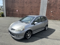
2007 Honda Fit $4,400
More info -
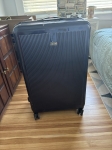
REVO luggage $100
More info
Garage Sales
-
House Contents Sale - Rain or Shine Sale Date: May 18, 2024
More info


The 24 hour satellite loop shows stuff rotating around the eastern half of the US, which might explain the ambiguity in the forecasts. I heard on the radio something to the effect that the forecasters are unusually unsure of their forecasts.
Click on the link marked "loop" here.