Tutorial on reading forecast models at the end of this thread.

As snowstorms go that was the cutest one ever. Did my walk in two passes and drove to a 9:45 appointment without drama. It was gorgeous!

carolanne said:
Where can one find the models if one wants to get more involved in watching the model rungs and what they predict as we get closer to an event?
Here's the NWS site: http://mag.ncep.noaa.gov/model-guidance-model-area.php#
You might want to start with the following settings:
Model Area = NAMER
Model Type = GFS
On the next page, try clicking 10m_wnd_precip
Then, on the next page, try a 4 or 5 day loop.
The system will run an animation that combines simulated radar for precipitation, wind barbs for wind speed, isobars to show pressure, and the freeze line at ground level (ok, actually at 35 feet above sea level, but, details). It steps in 3 hour increments.
If you are within 24 hours of the event, run the same parameters, but instead of the GFS, run the NAM.
These are the models managed by the NWS, and since we taxpayers are paying for them, they are free for us to use. Models like the Euro would require access through a paid site. Also, you can pay the NWS for more detail if you have that kind of free time and interest.
Here's one cell from running the GFS just now like I outlined above.


This is hour 63, counting from the initiation of the most recent completed run, which was from noon today. It is showing us what the weather might be like in North America at about 3 am on Monday.
There are four storms in view.
The first (let's read right-to-left, like Hebrew) is northwest of Prince Edward Island -- you can see a large letter "L" with the number 1005 under it. That weak system will develop over Canada late tomorrow and not affect us at all.
Number two is that lovely multi-colored splotch off the east coast. Good thing that sucker is well out to sea -- if it made landfall it would be a pretty classic nor'easter, but it is going to stay well out there. At least, it has on all the runs so far.
Number three is over Wisconsin.
Number four is just south of Alaska out in the Pacific.
If you keep running the model, at hour 66 a new low breaks off the one over Wisconsin and heads southeast into the Ohio Valley. By 84 (midnight Monday into Tuesday) it is a complex system off the the mid Atlantic coast. That is the one we are watching for overnight Monday into Tuesday. On this run, it snows steadily but never heavily on us for 24 - 33 hours. Total QPF on this run is about 1/2 inch of water, perhaps 5 - 7" of snow. But it will all change with the next run, and there are different solutions on other models.
And just like that, the output from the 6pm run has started to come up. It takes about 4 - 5 hours to actually run the simulation. It will show up on the website over the next 45 minutes or so, frame by frame.

Thanks Max! Going to try, but so glad you are here to interpret for us!


Interesting stuff. Thank you, Max.
And, just a reminder to anyone who is sick of the Northern Hemisphere winter weather, and who wants to see the sort of weather that joanne and I (we're in widely-separated locations) are experiencing here in Australia, that you can poke through our Bureau of Meteorology website free of charge at http://www.bom.gov.au/
A further reminder, winds in the Southern Hemisphere are reversed compared to those in the Northern Hemisphere .. ie in the Southern Hemisphere, winds travel clockwise around a Low Pressure system, and anti- (or counter-) clockwise around a High.
Now, back to your Northern Hemisphere weather... 

Thanks, Max! NWS is my go-to, and I often run the radar, but it helps to know what I'm doing. ;-)

I generally don't reference commercial meteorologists' sites, but I think Weather NJ has summed up this week perfectly with his Final Call forecast graphic, shown below:


For Sale
-
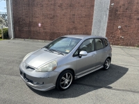
2007 Honda Fit $4,400
More info -

REVO luggage $100
More info


Garage Sales
-
House Contents Sale Sale Date: May 18, 2024
More info
Free Items

Sponsored Business


Promote your business here - Businesses get highlighted throughout the site and you can add a deal.

Where can one find the models if one wants to get more involved in watching the model rungs and what they predict as we get closer to an event?