WINTER WEATHER ADVISORY: CANCELLED

The above is probably the best guess as to what is going to happen, but the forecasters are literally hedging their hedges.
There are three systems working through the area from now until Thursday. Two of them are going to generate powerful storms, and the models are mostly showing the storms well off shore.
The western edge of the precipitation, though will keep drifting over us, and we should see snow on and off for most of the week, without serious (more than an inch or two) accumulations over any 12-hour period.
1) The models have been unreliable this winter, especially but certainly not limited to the formally gold-standard Euro, which got both the last three storms very wrong.


2) The models have consistently failed by showing storms offshore, and then at the last minute moving them much closer.
3) If that happens with two of these systems, we could see over a foot easily.
That said, at this time these systems seem to be set up in a way that will keep them out to sea. But no one at this point is confident enough to put a pin in it and say "done."

Groan. Have to drive to Hartford tomorrow morning for a funeral. Need to be there by 1 PM. Yuck.


Well, I'm hoping for small amounts of annoying snow, but nothing we can do if it turns out to be a French toast storm...


Max Max Max - I have surgery scheduled Wednesday am at 7..Have to drive to Millburn from So Orange and we the doctor has to be able to get there. And I have to use crutches or a wheelchair. Please keep most of the storm offshore..Thankey!


mfpark said:
Groan. Have to drive to Hartford tomorrow morning for a funeral. Need to be there by 1 PM. Yuck.
FWIW, I'd use the western route. GSP to Tap then Saw Mill to 684 etc. Similar to the last storm, the precipitation field is biased toward the coast.

yep an inch or so a days would be great. I haven't been grocery shopping in over a week, maybe even two weeks, so, it's sure to come ashore. Apologies.
carolanne said:
yep an inch or so a days would be great. I haven't been grocery shopping in over a week, maybe even two weeks, so, it's sure to come ashore. Apologies.
Not necessary. I said to the butcher at Ashley that with this weather, I'd been hiding in my house and he asked me why would I hide in my own house. LOL! I guess he didn't get that I wasn't actually hiding...

max_weisenfeld said:
But
^ Award for most ominous use of a conjunction on a MOL thread.

I have Hamilton tickets for Wednesday night. So of course we will get a foot of snow

max_weisenfeld said:
3) If that happens with two of these systems, we could see over a foot easily.
Maybe this is punishment for all of the fizzles in years past.
Winter Weather Advisory
URGENT - WINTER WEATHER MESSAGE
NATIONAL WEATHER SERVICE NEW YORK NY
431 AM EST MON FEB 8 2016
...HEAVY SNOW ACROSS CENTRAL AND EASTERN SECTIONS OF LONG ISLAND
AND SOUTHERN CONNECTICUT TODAY...
NJZ004-006-103>108-NYZ068-069-081745-
/O.EXA.KOKX.WW.Y.0004.000000T0000Z-160208T2300Z/
EASTERN PASSAIC-HUDSON-WESTERN BERGEN-EASTERN BERGEN-
WESTERN ESSEX-EASTERN ESSEX-WESTERN UNION-EASTERN UNION-PUTNAM-
ROCKLAND-
431 AM EST MON FEB 8 2016
...WINTER WEATHER ADVISORY IN EFFECT UNTIL 6 PM EST THIS
EVENING...
THE NATIONAL WEATHER SERVICE IN UPTON HAS ISSUED A WINTER WEATHER
ADVISORY FOR SNOW...WHICH IS IN EFFECT UNTIL 6 PM EST THIS
EVENING.
* LOCATIONS...MUCH OF NORTHEAST NEW JERSEY AND THE LOWER HUDSON
VALLEY.
* HAZARD TYPES...ACCUMULATING SNOW.
* ACCUMULATIONS...SNOW ACCUMULATION OF 2 TO 3 INCHES.
* WINDS...NORTHEAST 10 TO 15 MPH WITH GUSTS UP TO 25 MPH.
* TEMPERATURES...IN THE LOWER 30S.
* TIMING...SNOW WILL DEVELOP AFTER DAYBREAK...AND CONTINUE INTO
THE AFTERNOON.
* IMPACTS...HAZARDOUS TRAVEL CONDITIONS DUE TO SNOW COVERED
ROADS.
PRECAUTIONARY/PREPAREDNESS ACTIONS...
A WINTER WEATHER ADVISORY FOR SNOW MEANS THAT PERIODS OF SNOW
WILL CAUSE TRAVEL DIFFICULTIES. BE PREPARED FOR SLIPPERY ROADS AND
LIMITED VISIBILITIES...AND USE CAUTION WHILE DRIVING.
sarahzm said:
I have Hamilton tickets for Wednesday night. So of course we will get a foot of snow
Nooooooooo!
carolanne said:
when is it supposed to start?
Any time between now and noon. We are on the far western edge of the precipitation field. It is struggling to get to us at all.


While the Advisory remains in effect, there is little likelihood of significant snow in our immediate area today. Be aware, though, that it is snowing quite heavily on Long Island and in central Connecticut. We remain just outside the edge of what is a major storm that is mostly out to sea.
Tonight, we may get an inch or two.
The rest of the forecast continues to suggest that there could be periods of light snow through Wednesday, but the chances of significant snowfall are diminishing.
I'm sorry Max. I'd give you a big storm for your birthday if I could. > <
<
Thanks Max - I didn't even bother with accuweather, I just came right here for the facts...

VERRRRRY light snow falling in Long Island City right now, and it doesn't seem cold enough to stick.
Glad to hear this!!! Especially because I wore stupidly impractical shoes to work
Sponsored Business


Promote your business here - Businesses get highlighted throughout the site and you can add a deal.
For Sale
-
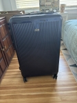
REVO luggage $100
More info


Tonight
A slight chance of snow after 3am. Mostly cloudy, with a low around 32.
Northeast wind 6 to 13 mph. Chance of precipitation is 20%.
Monday
A chance of snow, mainly before 3pm. Cloudy, with a temperature falling
to around 31 by 3pm. Wind chill values between 20 and 25. Northeast wind
9 to 15 mph. Chance of precipitation is 50%.
Monday Night
Snow likely, mainly after midnight. Cloudy, with a low around 24. Wind
chill values between 15 and 20. Northeast wind around 9 mph. Chance of
precipitation is 60%. New snow accumulation of 1 to 2 inches possible.
Tuesday
Periods of light snow. High near 34. Wind chill values between 15 and 25.
Northeast wind 8 to 10 mph. Chance of precipitation is 80%. New snow
accumulation of 1 to 2 inches possible.
Tuesday Night
Periods of light snow. Low around 28. Northeast wind around 6 mph becoming
calm. Chance of precipitation is 80%. New snow accumulation of 1 to 2
inches possible.
Wednesday
Periods of light snow. High near 38. Chance of precipitation is 80%. New snow accumulation of less than a half inch possible.
Wednesday Night
A chance of light snow. Mostly cloudy, with a low around 24. Chance of precipitation is 50%.
Thursday A chance of light snow before 5pm. Mostly cloudy, with a high near 32. Chance of precipitation is 30%.