The bottom of the map was well into the tri-state region. Big difference obviously.
uh-huh. sure. is hyper-local MAPSO on that map?
The southern tip of the map is within 30 miles of mapso. Big difference than a map whose southern most end is near Nantucket but I’m sure you already knew that. Now, all that said, I don’t want to continue having a conversation with a troll so good day Sir.
Hey @max_weisenfeld, it's been a while since we got any real data up in here. Do you have some more recent forecasts? Thanks.
sorry, I was so impressed by the success of redfruit's trolling that I forgot to post my last update. But it basically said "everything's on track, carry on"
Hey @max_weisenfeld, it's been a while since we got any real data up in here. Do you have some more recent forecasts? Thanks.
sorry, I was so impressed by the success of redfruit's trolling that I forgot to post my last update. But it basically said "everything's on track, carry on"
Max -- with all the weather maps you've posted over the years, I'd like to thank you for developing my ability to quickly recognize many states/regions/counties/cities along the east coast (and maybe even a bit of the midwest) quite quickly. This ability seems to function well, even with various types of overlays and graphics around and through the maps.
And I have developed an understanding of how even though there may be only one connected storm, it can create more extreme weather in some places that are outside the MAPSO area. And finally, you've helped it become clear that models are just estimates and expected patterns, so in reality the extremes could shift closer to us, or farther away. Thank you, again. I am no longer afraid of maps of other regions/states.
Hey @max_weisenfeld, it's been a while since we got any real data up in here. Do you have some more recent forecasts? Thanks.
sorry, I was so impressed by the success of redfruit's trolling that I forgot to post my last update. But it basically said "everything's on track, carry on"
I guess you were waiting for it to begin snowing before you could finally tell us it’s going to snow! LOL
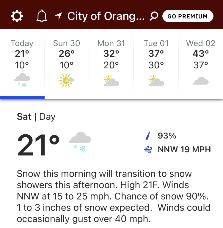
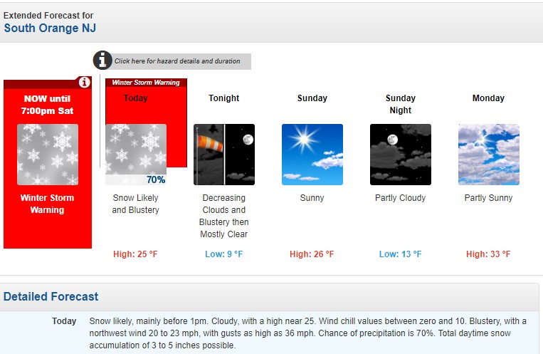
Forecast on track for 5 - 7 inches total, likely 3 or 4 still to go as of 8am.
While heavy snow bands have set up as forecast from the city east, especially affecting Long Island, our immediate area remains on the western edge of the precipitation. Snow should remain moderate this morning, starting to taper off after noon, and snowfall should end after 2pm.
The main event here is the wind, blowing a steady 20 - 25 with some gusts to 40. This is causing blowing and drifting that will continue through the afternoon, likely even after the snowfall stops. Ironically, the wind lowers the total snow accumulation by breaking and compacting somewhat the snowflakes (the official term seems to be "fracturing the dendrites").
Cold air will settle in this afternoon and linger through Monday, so face it, we're going to have to shovel this one.
Most of us who read this pinned thread for trusted analysis from Max and WXnut. Perhaps people could start a separate thread for their own attempts at forecasts, witty banter, trolling, etc.
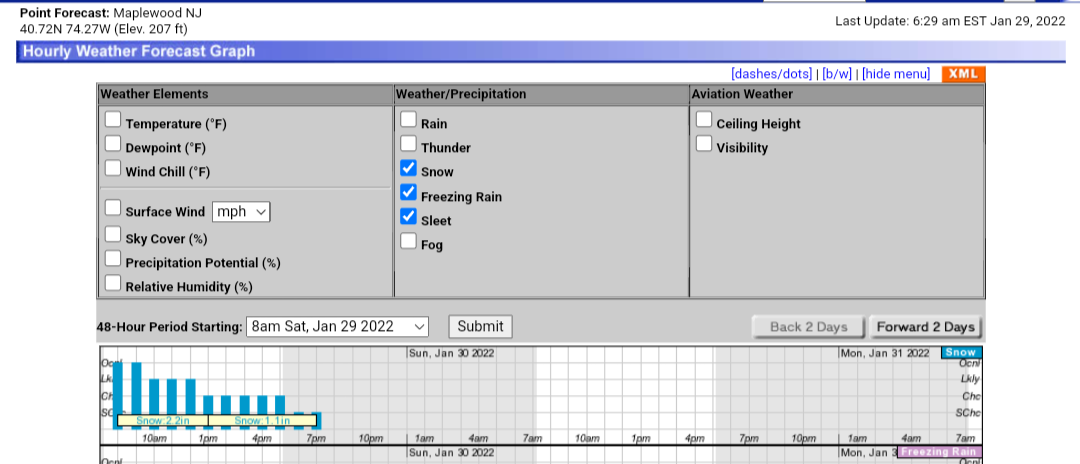
Storm continues to develop as forecast. It is now highly unlikely that we will have significant banding or a big thump of additional snow. Snow likely to continue until 2 or 3pm, tapering off slowly from now until then. Winds likely to persist into the early evening.
Storm continues to develop as forecast. It is now highly unlikely that we will have significant banding or a big thump of additional snow. Snow likely to continue until 2 or 3pm, tapering off slowly from now until then. Winds likely to persist into the early evening.
Perfect timing. This snow seems easy to move so I'll get out there once it's slowed down and clean it all up.
I just returned from shoveling. The snow did not hold together well to form a snowball. It seemed “light and dry”. So I expected a shoveful of snow to be light. It was not. Not “bag of cement heavy” like a snow followed by rain event, but heavier than anticipated, based on my snowball-making attempt. I think the dendritic fracturing that Max mentioned explains this. Thank you Max.


Hey @max_weisenfeld, it's been a while since we got any real data up in here. Do you have some more recent forecasts? Thanks.